PAGE CONTENTS
Objectives
There are two main objectives of the project. The first one is to develop and experimentally validate propagation models and relevant input data for the statistical prediction of radio interference on ground terminals of satellite systems. The second one is to implement the models into a software tool.
As it is obvious that the main important effects that need to be considered are diffraction and the atmospheric refraction, these two effects and their corresponding models are addressed in more details utilizing dedicated measurements. For the other effects, available models and experimental data have been adopted.
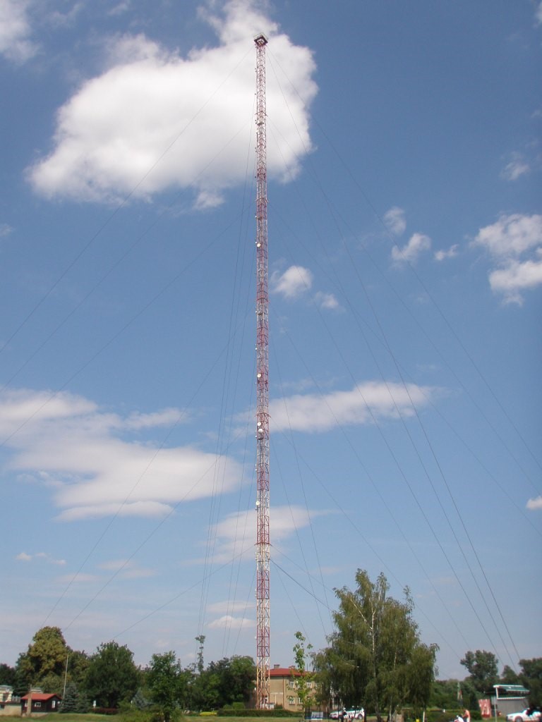
Figure 1: long-term measurements
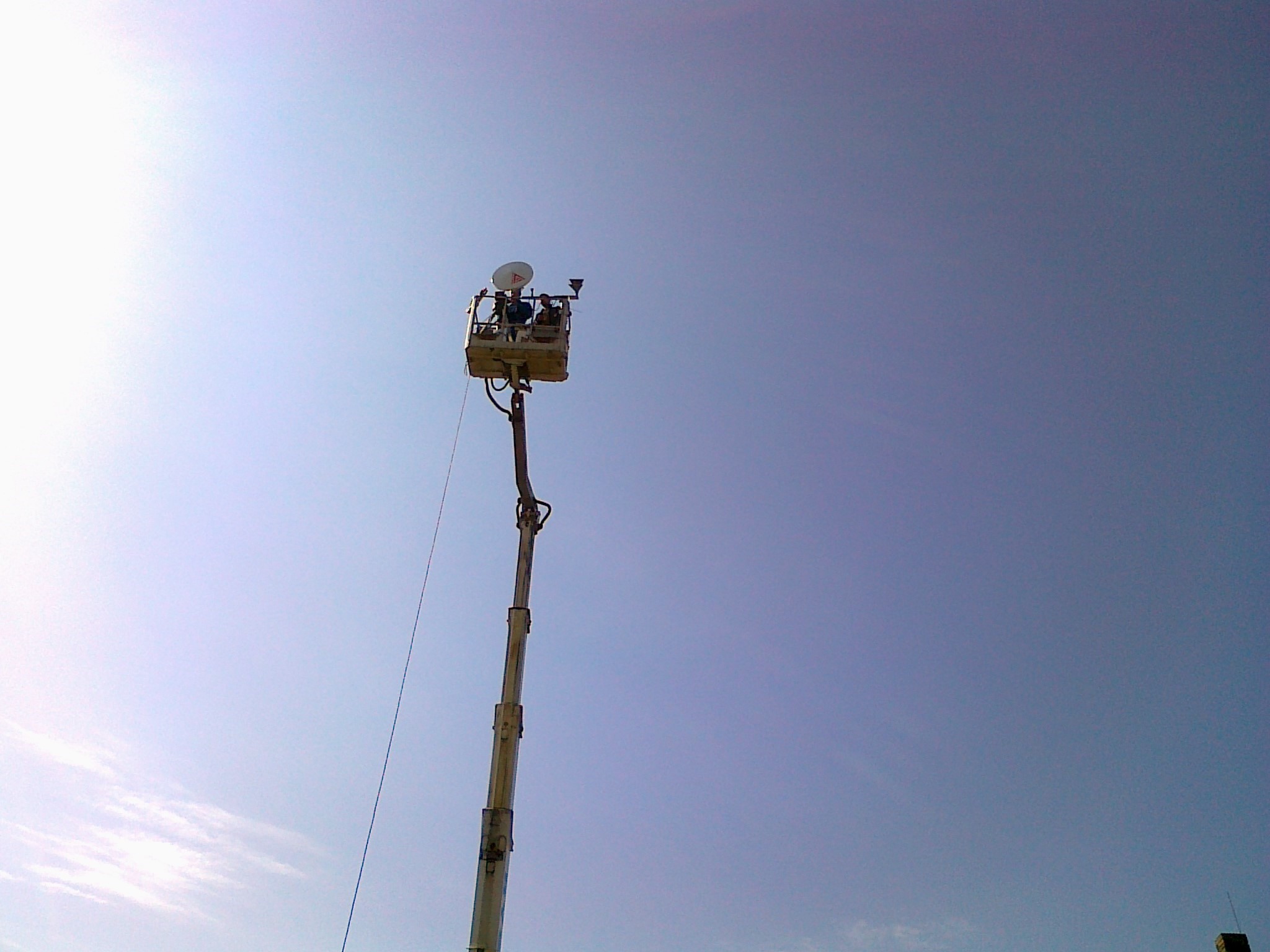
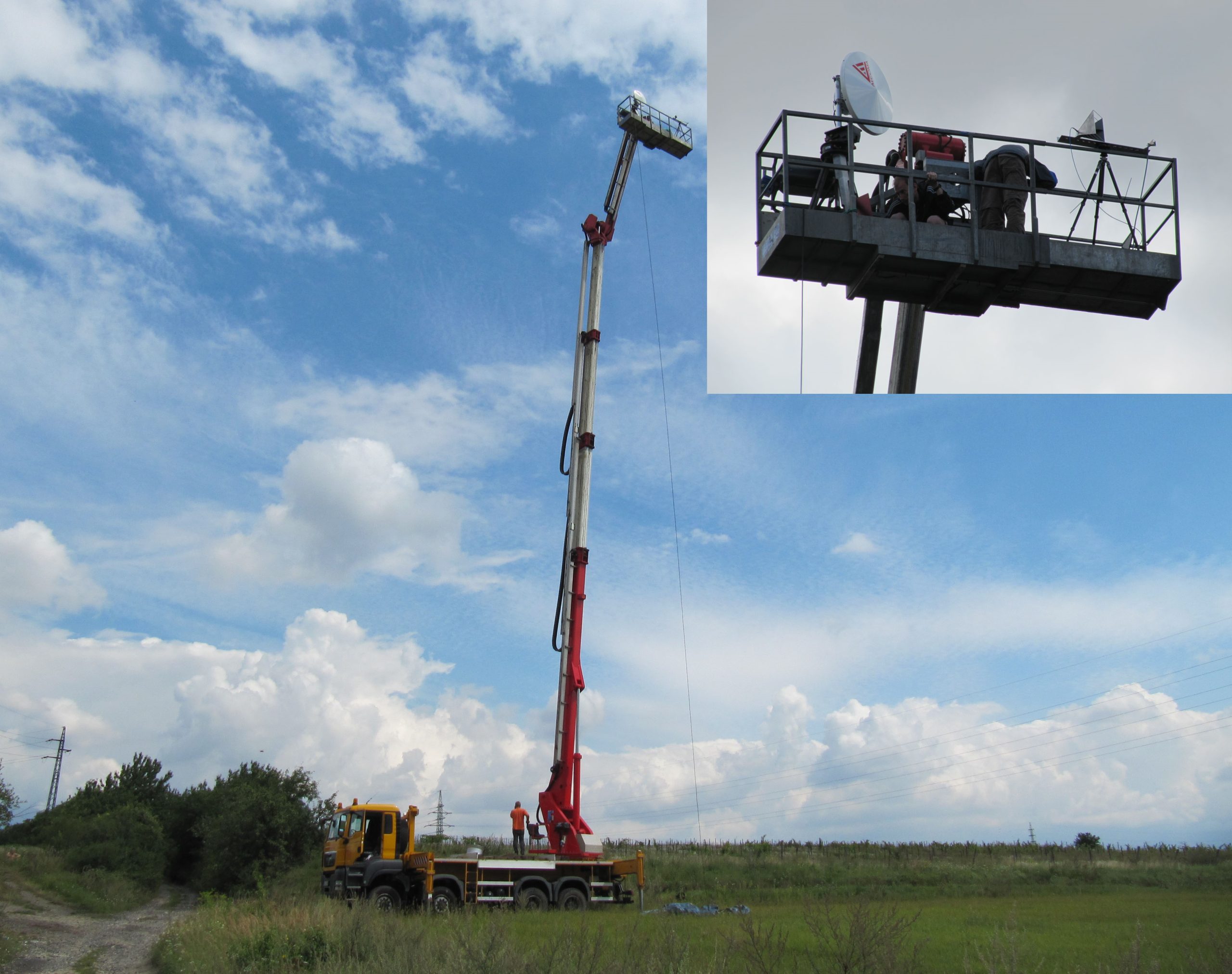
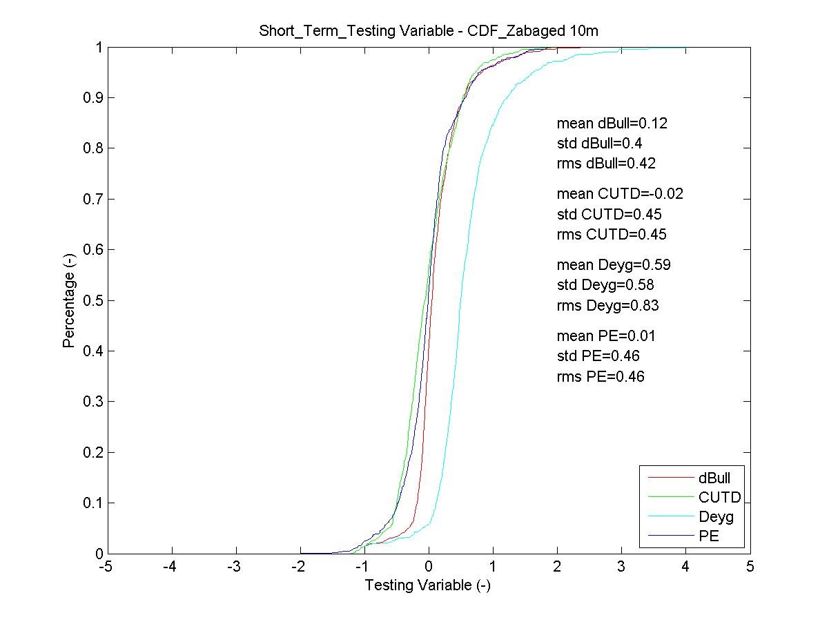
Figure 2: short-term measurements
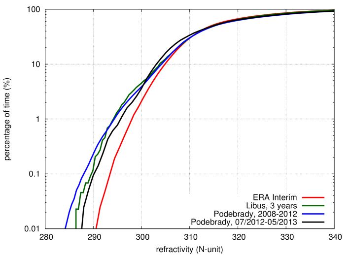
Figure 3: comparison between the new maps and local data
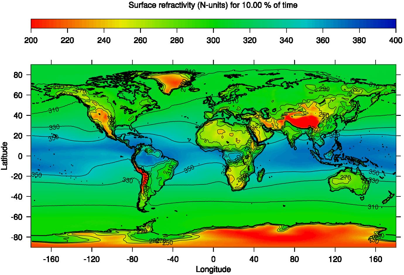
Figure 4: World map of surface refractivity quantile corresponding to 10% of time
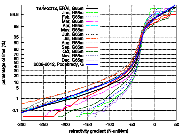
Figure 5: Monthly cumulative distributions of the vertical gradient in the lowest 65 m above surface; latitude 50.25, longitude 15.00
Challenges
There are several key challenges related to each work package, namely providing global world map of refractivity based on the ERA‑Interim database (WP2), developing a new propagation model for diffraction (WP3), carrying out the short-term (WP4) and long-term (WP5) experiments, testing of the selected propagation models (WP6) and implementation of the SW tool (WP7).
In frame of CCN, the ERA-Interim datasets were processed so that monthly and whole year radiometeorological maps with 0.75° spatial resolution were produced (WP10), the current ITU-R 452-14 clutter loss model was compared with a UTD approach (WP11) and the SW tool was updated accordingly (WP12).
Plan
The project duration has been 18 months and the corresponding work was split into nine work packages: state-of-the-art review (WP1), input data and maps processing (WP2), model development (WP3), short‑term measurements (WP4), long‑term measurements (WP5), interference models testing (WP6), SW tool implementation (WP7) and validation (WP8), management and reporting (WP9).
Within CCN, the project was extended by three months and three additional work packages: new radiometeorological maps with even finer resolution (WP10), clutter loss modeling (WP11) and SW tool upgrade (WP12) enabling to read the RAPIDS inputs as well.
Current Status
The project including its CCN has been successfully finished in 2014 and all the required deliverables have been provided.
Companies